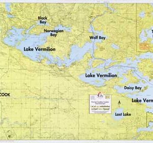
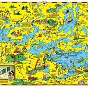
• Maps
    • Books & Guides
    • E Series Maps
    • F Series Maps
    • Voyageurs National Park Maps
    • Historic/Cartoon Maps
    • Map Sets
    • Wall Murals
  • Gifts
    • Puzzles
    • Post Cards
    • Gift Wrap
    • Note Cards
  • Clothing
    • Sweatshirts
    • T-Shirts
  • Retail Locations
  • Contact
  • My account
  • Cart
What can we help you find today?
Fisher Maps
  • Maps
    • Books & Guides
    • E Series Maps
    • F Series Maps
    • Voyageurs National Park Maps
    • Historic/Cartoon Maps
    • Map Sets
    • Wall Murals
  • Gifts
    • Puzzles
    • Post Cards
    • Gift Wrap
    • Note Cards
  • Clothing
    • Sweatshirts
    • T-Shirts
  • Retail Locations
  • Contact
C-6: Large Lake Vermilion Classic Map Wall Mural
C-6: Large Lake Vermilion Classic Map Wall Mural - Image 2
C-6: Large Lake Vermilion Classic Map Wall Mural - Image 3
C-6: Large Lake Vermilion Classic Map Wall Mural - Image 4

C-6: Large Lake Vermilion Classic Map Wall Mural

$50.00 – $130.00

Clear Selection
SKU: C-6-1 Categories: Historic/Cartoon Maps, Maps, Wall Murals
  • Description

Description

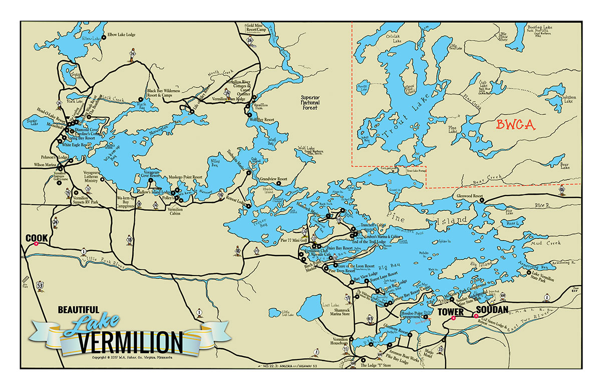
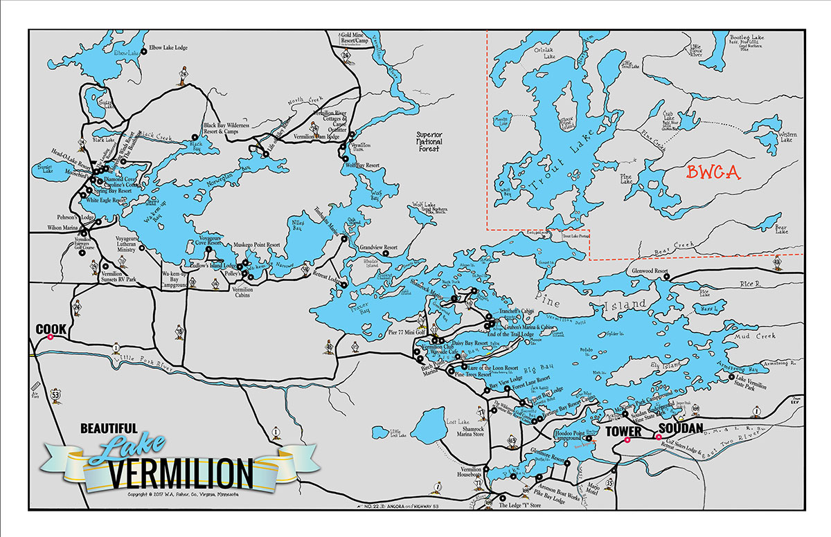
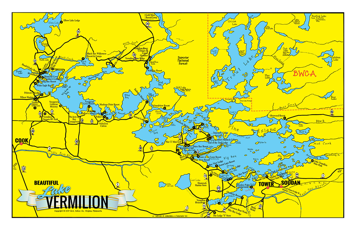
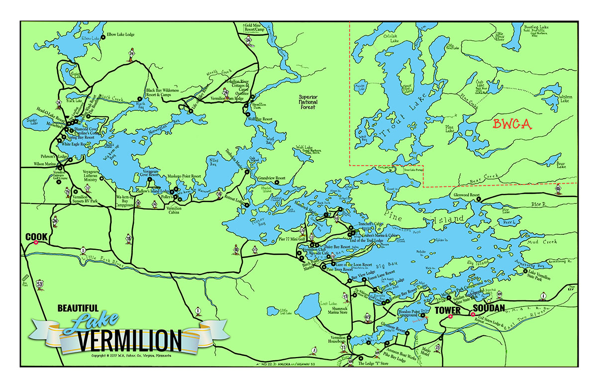
Similar to our Large Lake Vermilion Cartoon Map, without the cartoon sketches and historical information. Available in four colors.

Lakes on Map

Bass Lake, Elbow Lake, Lake Vermilion, Little Lost Lake, Little Trout Lake, Lost Lake, Pine Lake, Sunset Lake, Trout Lake, Western Lake

Rivers on Map

Armstrong River, East Two River, Little Fork River, Little Sioux River, Rice River, Vermilion River

You may also like…

F-8: Lake Vermilion, Trout Lake, Vermilion River, Bootleg Lake

F-8: Lake Vermilion, Trout Lake, Vermilion River, Bootleg Lake

$10.00
Add to cart
F-1: West Lake Vermilion, Trout Lake, Lost Lake

F-1: West Lake Vermilion, Trout Lake, Lost Lake

$10.00
Add to cart
C-3: Large Lake Vermilion Cartoon Map

C-3: Large Lake Vermilion Cartoon Map

$40.00 – $220.00
Select options
C-2: Lake Vermilion Cartoon Map

C-2: Lake Vermilion Cartoon Map

$10.00
Add to cart

Related products

F-29: Jean Lake, Batchewaung Lake, West Pickerel Lake

F-29: Jean Lake, Batchewaung Lake, West Pickerel Lake

$10.00
Add to cart
F-31: Ely Area Entry Point Map

F-31: Ely Area Entry Point Map

$12.00
Add to cart
F-28: Beaverhouse Lake, Cirrus Lake, Quetico Lake

F-28: Beaverhouse Lake, Cirrus Lake, Quetico Lake

$10.00
Add to cart
F-26: McKenzie Lake, Powell Lake

F-26: McKenzie Lake, Powell Lake

$10.00
Add to cart
  • Product Categories

    • Boundary Waters Canoe Area & Quetico Provincial Park (18)
    • Clothing (6)
      • Sweatshirts (2)
      • T-Shirts (4)
    • Gifts (18)
      • Gift Wrap (1)
      • Koozies (1)
      • Note Cards (6)
      • Post Cards (5)
      • Puzzles (5)
    • Maps (85)
      • Books & Guides (5)
      • E Series Maps (24)
      • F Series Maps (37)
      • Historic/Cartoon Maps (15)
      • Map Sets (6)
        • Large (5)
        • Small (1)
      • Voyageurs National Park Maps (4)
      • Wall Murals (6)
    • North Shore - Gunflint Trail (3)
    • Voyageurs National Park (9)
  • Cart

Shop
  • Boundary Waters Canoe Area & Quetico Provincial Park
  • Lake Vermilion Maps
  • Namakan Lake Maps
  • Lake Kabetogama Maps
  • Basswood Lake Maps
  • North Shore – Gunflint Trail
  • Voyageurs National Park
  • Lac La Croix Maps
  • Lake of the Woods Maps
  • Lake Winnibigoshish Maps
  • Snowbank Lake Maps
About

W.A. Fisher dedicated his life to mapping some of the nation’s wildest country, an endeavor that allows us to help thousands of people enjoy some of nature’s coolest scenery. Thanks to Mr. Fisher, we’re able to provide some of the finest Minnesota lake maps, boating maps, fishing maps and canoeing maps and guide books on the market.

218-741-9544 | orders@fishermaps.com

You can purchase items using PayPal at checkout.

PayPal

©2025 W.A. Fisher Co | 123 Chestnut Street | Virginia, MN 55792 | Store Policies | Report Problems